Trump posts map showing Strait of Hormuz as US territory
 SKAiF NewsNG SNN
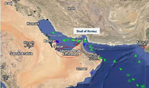
US President Donald Trump on Tuesday posted a map on his Truth Social platform showing the Strait of Hormuz as “NEW U.S. Territory,” pressing his threat to claim sovereignty over the vital waterway.
Iran has effectively shut down the chokepoint, through which a fifth of the world’s oil transits, in retaliation for the war Trump started along with Israel in late February.
Trump first raised the idea of a US takeover on Friday, saying in a jovial-sounding tone he would soon declare it to be US territory — prompting Iran to retort that the strait “will remain Iranian.”
Trump revisited the idea again Monday in comments to reporters in the Oval Office, suggesting it would be a good idea.
This is not the first time that Trump, faced with a foreign policy obstacle, has threatened to annex foreign territory.
Since returning to power in 2025, he has threatened to make Canada the 51st US state, seize Greenland and has even alluded to taking control of the Gaza Strip, without following through on any of these threats.
Before the Iran war erupted on February 28, the Strait of Hormuz was an open, international waterway.
Iran says it will not reopen the strait until the United States meets a sweeping list of demands including ending the US blockade of Iran’s ports, lifting oil sanctions, freeing up frozen Iranian assets and paying war damages.
AFP
The post Trump posts map showing Strait of Hormuz as US territory appeared first on Vanguard News.